The Parramatta Escarpment Boardwalk is a city-shaping piece of infrastructure for Parramatta. Along with the Lennox Bridge Portals, the boardwalk resolves missing links to create continuous foreshore access for pedestrians and cyclists from the University of Western Sydney at Rydalmere to Parramatta Park.
The project builds on the City of Parramatta’s ambition to refocus the city to the river, and will contribute to making the waterfront a place for celebrations, activation and recreation.
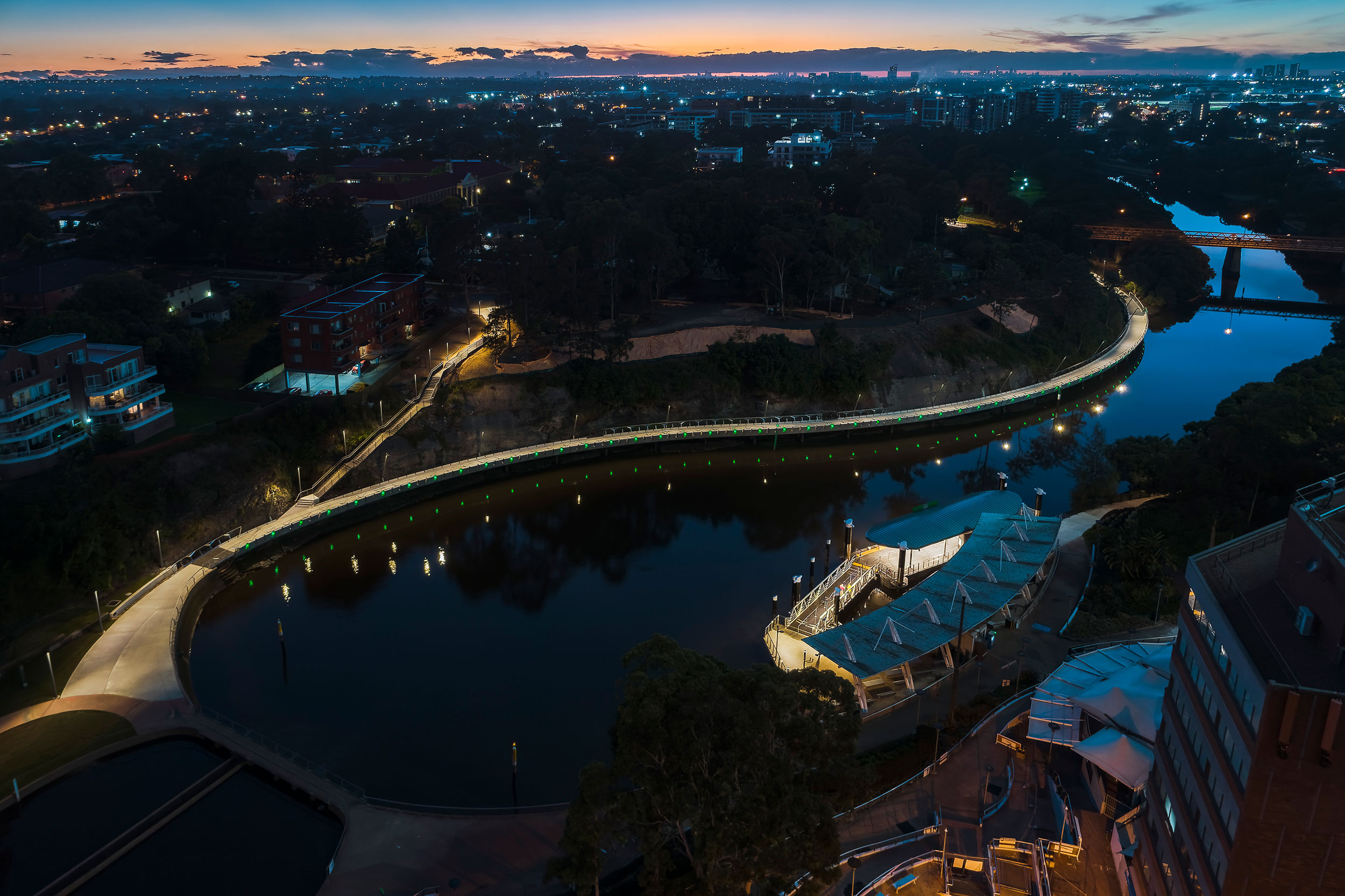
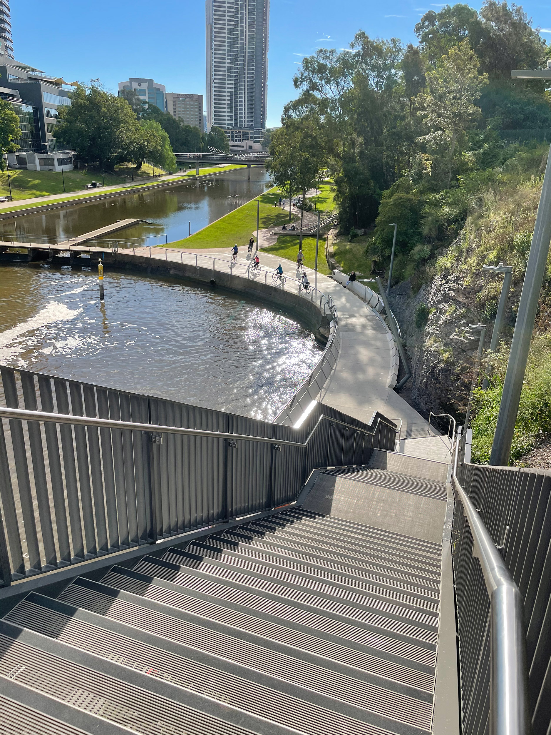
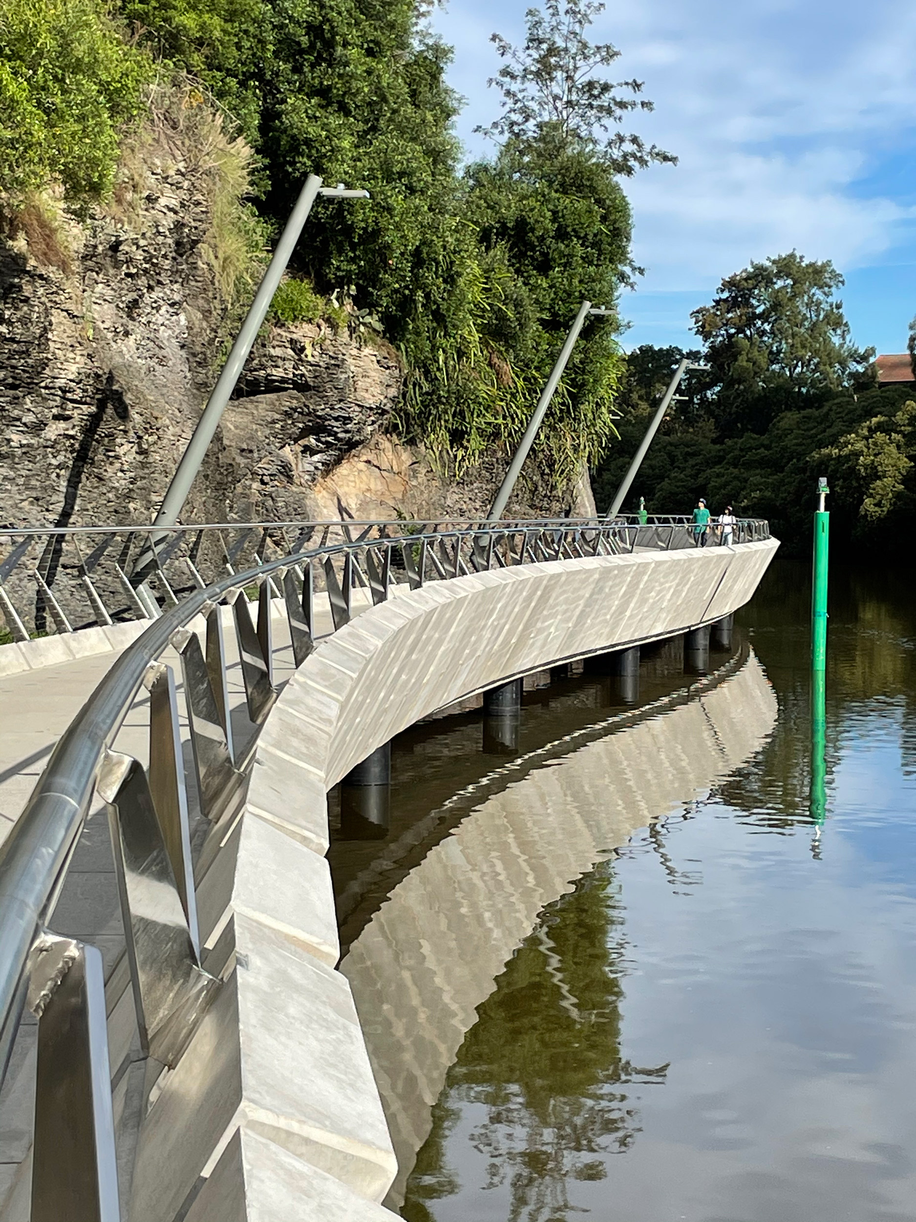
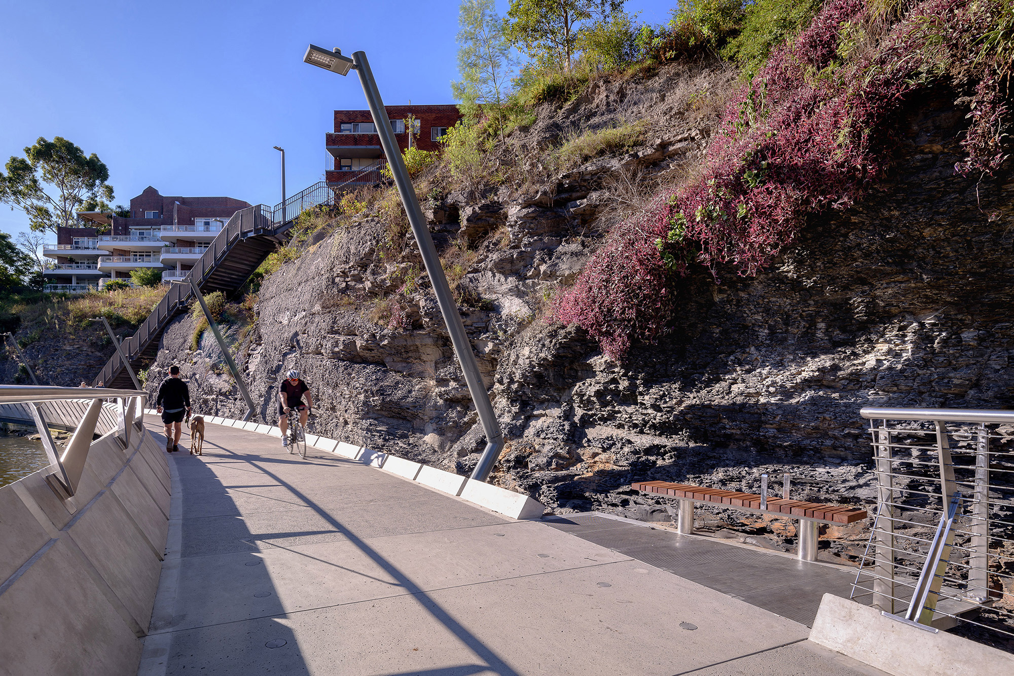
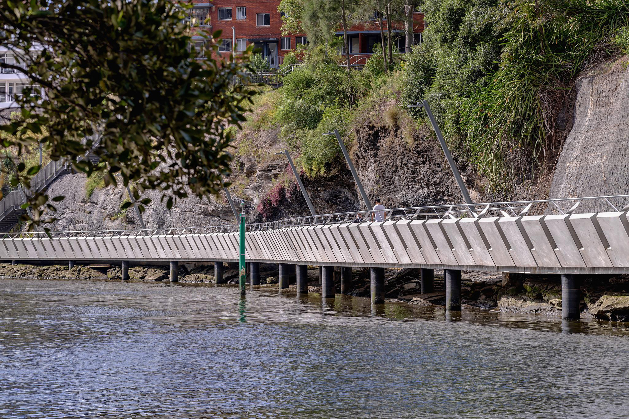
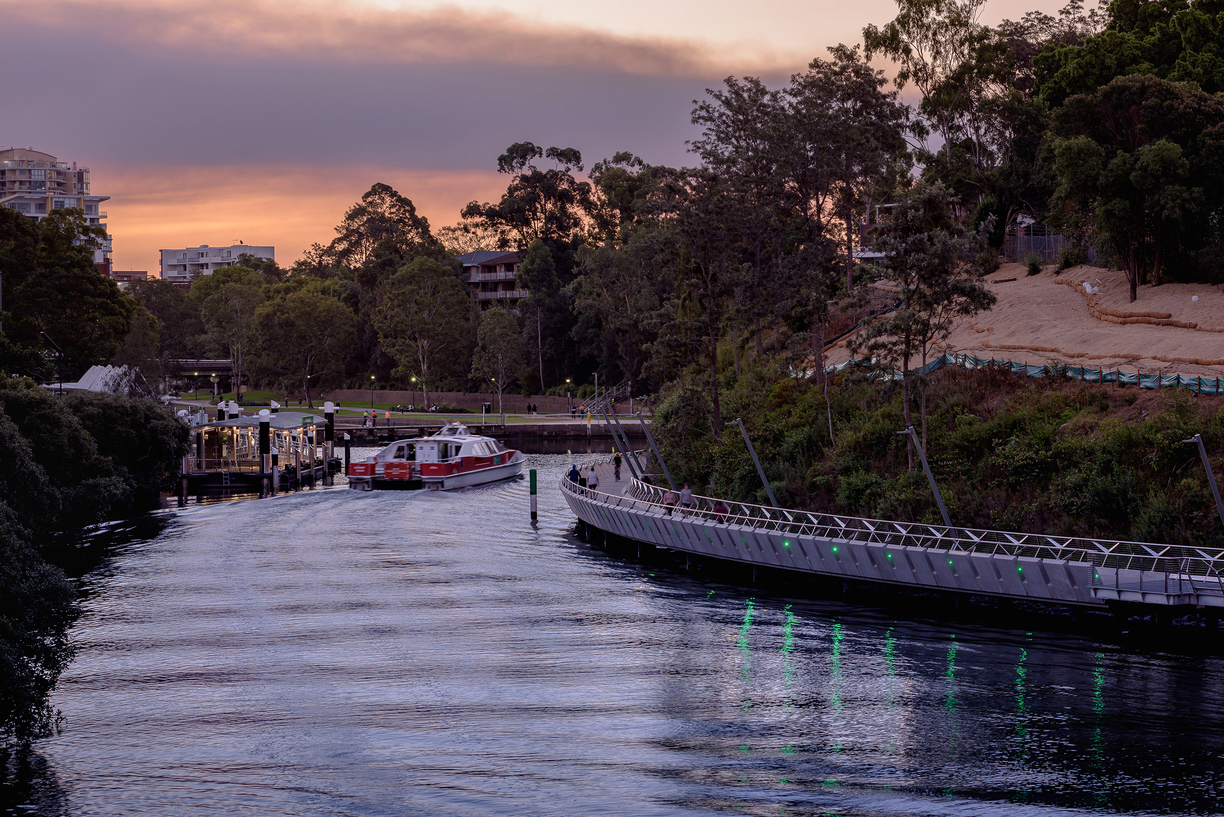
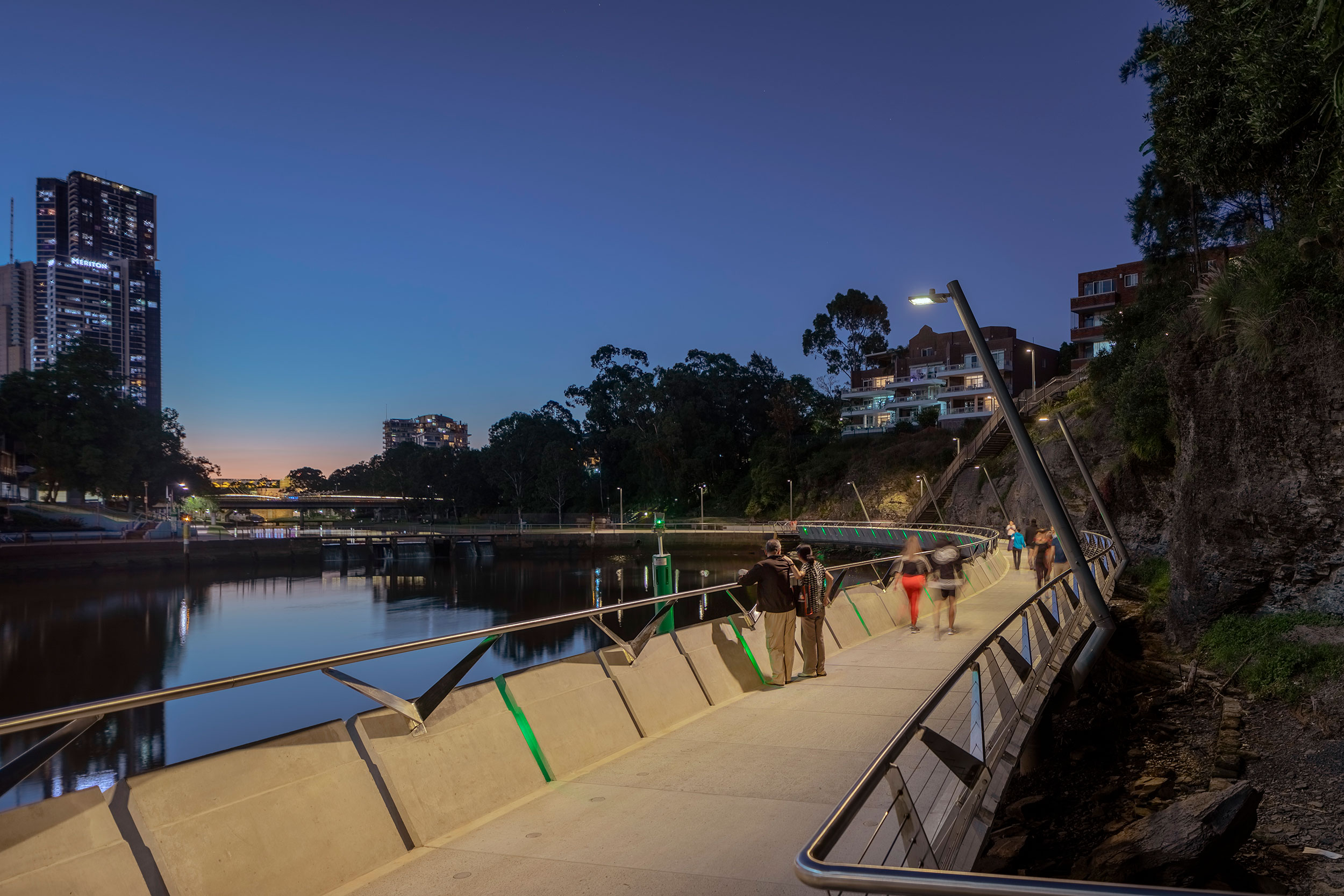
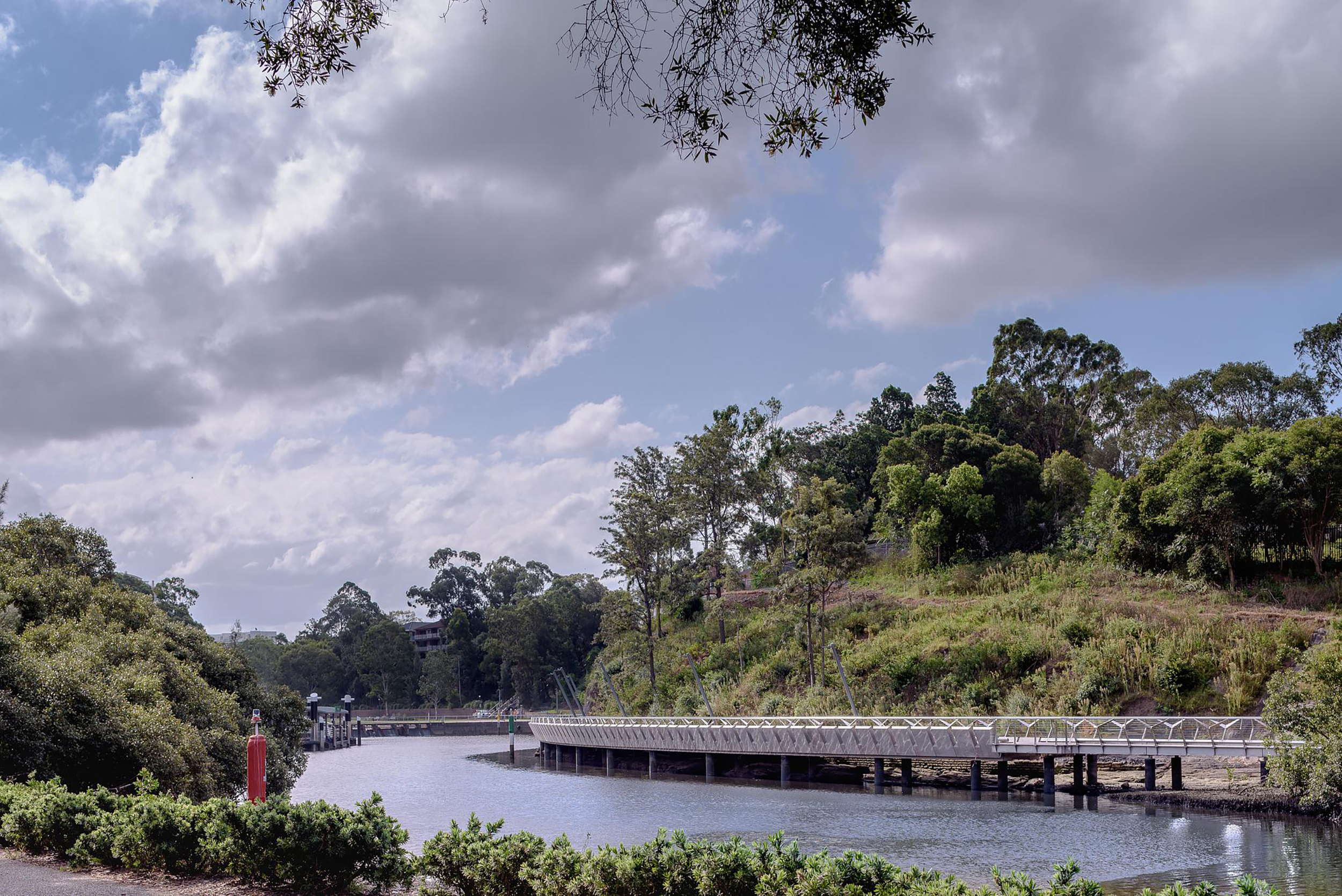
The Boardwalk, in combination with the weir, ferry wharf reconstruction and future Charles Street Square, redefines the form and maritime arrival as Parramatta Quay – making the western complement to Circular Quay. The boardwalk’s sinuous alignment adds to the site’s inherent spatial drama, elevated on piles over the river waters and following the re-shaped shale escarpment to provide a memorable entry to Parramatta.
The slowing of the Rivercat Ferry’s speed signals entry into a part of the harbour/river foreshore that is strongly characterised by its ecology (mangroves, saltmarsh, tall eucalypts above) and infrastructure works (bridges, weirs, wharves). As the ferry approaches the final bend in the river, the towers of the Parramatta’s city centre appear, rapidly growing in size until the ferry arrives at the amphitheatre before the wharf, turning in a broad sweep to set down its passengers.
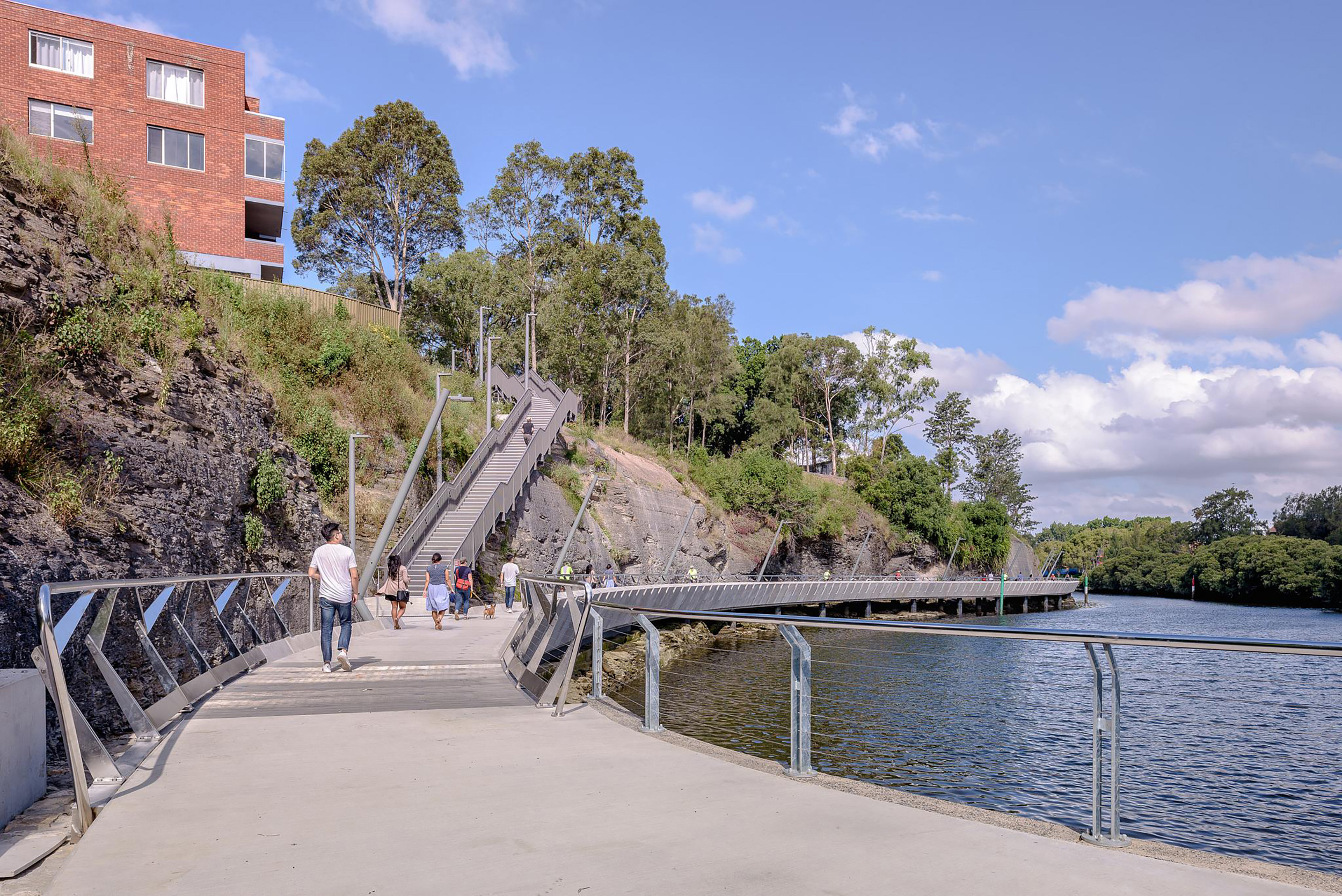
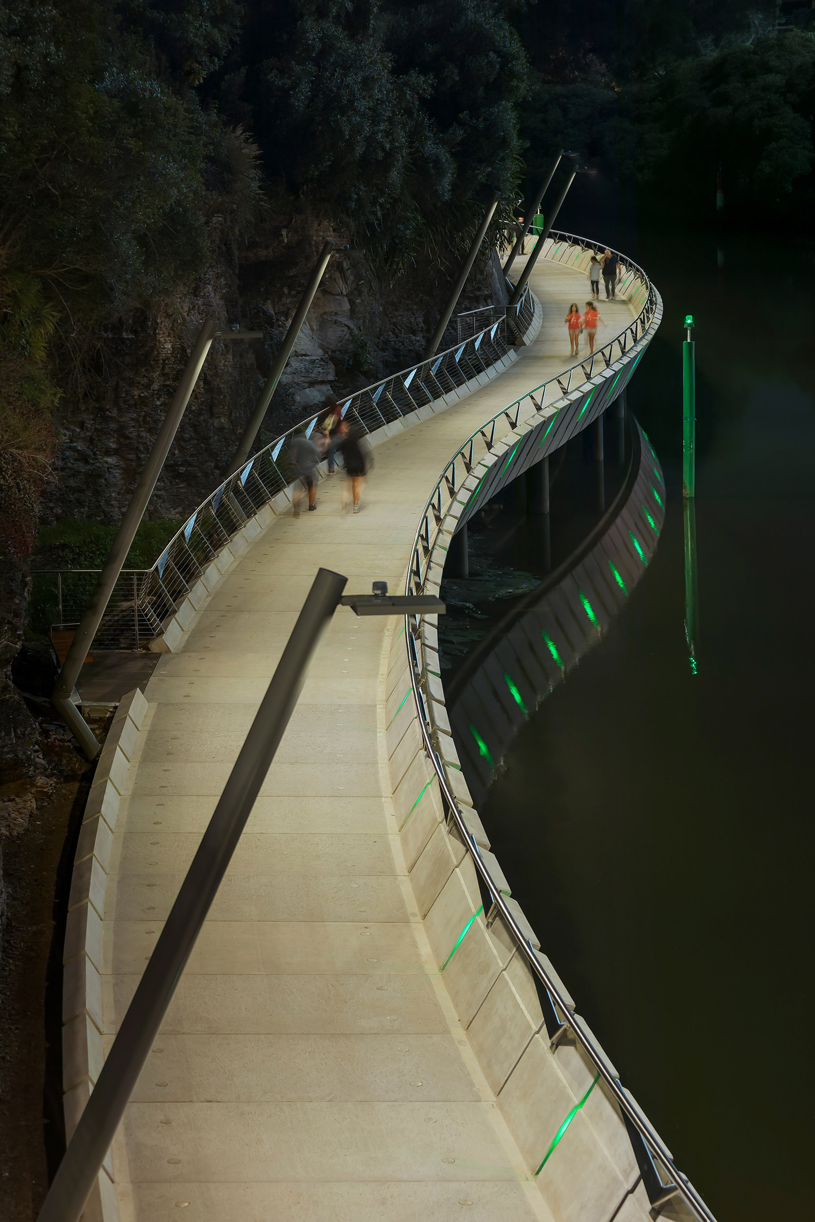
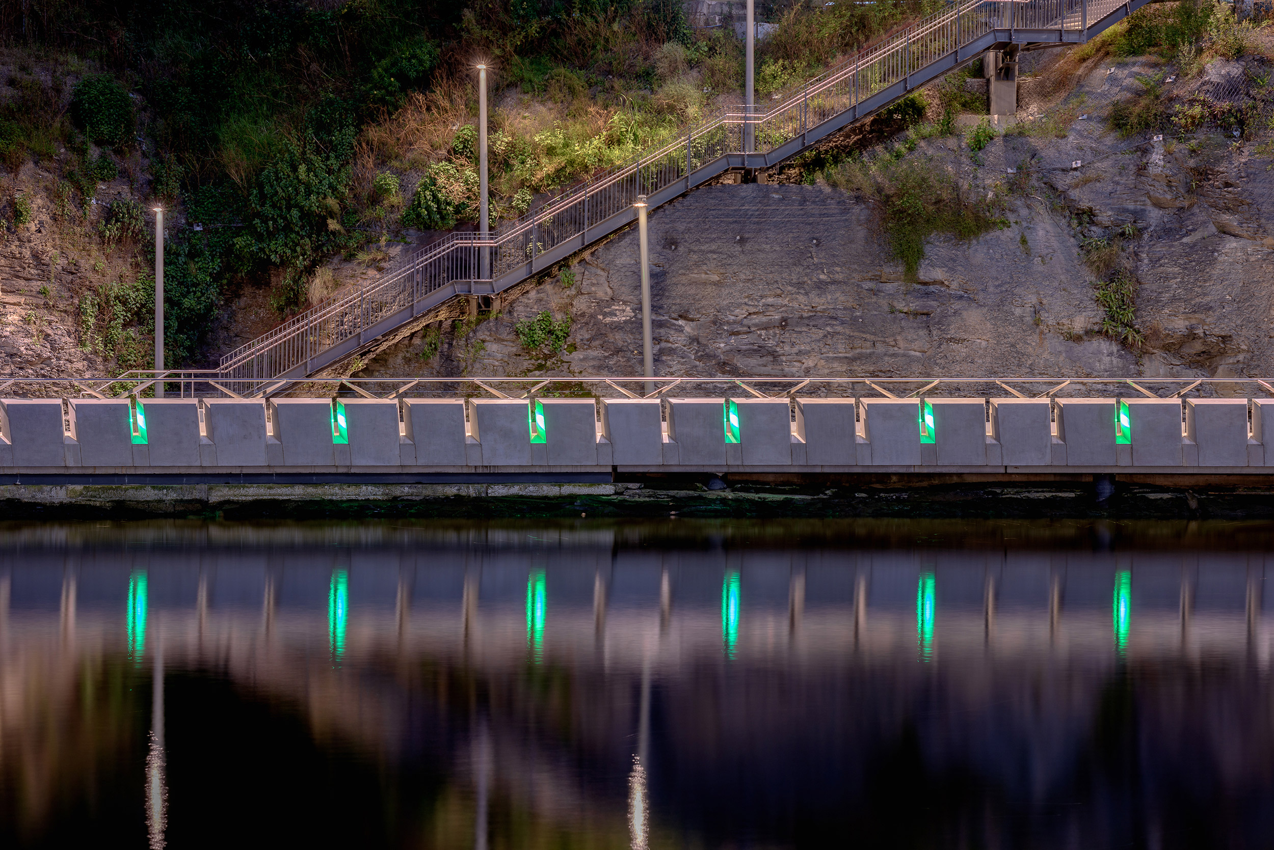
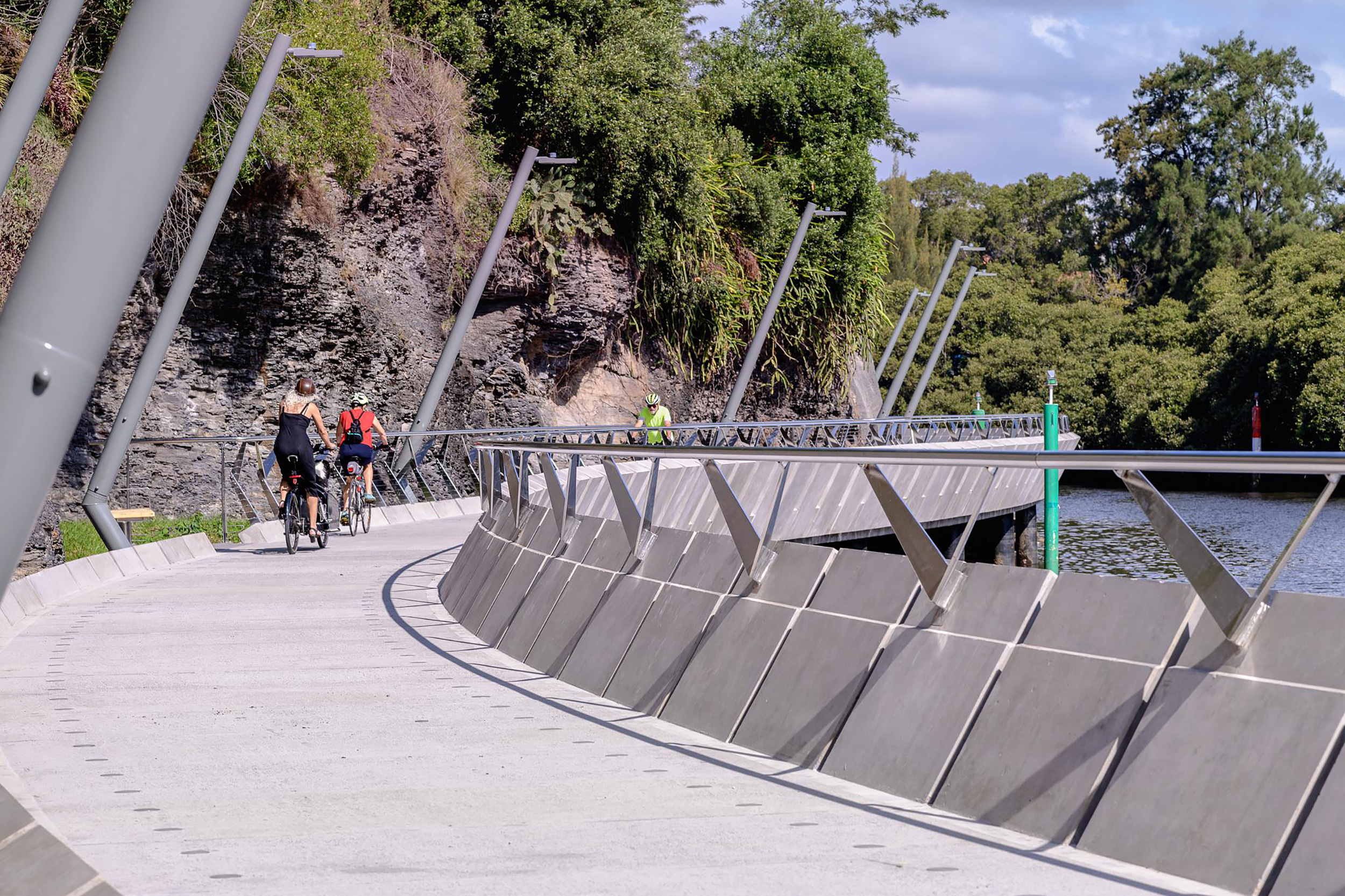
The new path and boardwalk geometry are threaded between navigable waterway and the escarpment. Its distinctive geometry seamlessly resolves the site’s technical challenges, reconciling tide levels and riverside ecology, public safety and ferry impact, friable shale and stairways, with sensitivity to proximate heritage-listed weir and bridge. The path is episodic; longer and straighter in some sections, and more curving and sinuous in others. New steel staircases connect to Gasworks Bridge in the east, and Stewart Street and Macarthur Girls High School to the west, significantly improving accessibility to the riverfront and city centre. The night image is also compelling, with inset low-level green lights augmenting the navigational markers and the rhythm of the pole lighting.
The robust structure is designed to withstand the intermittent floods. Path widths, materials, alignments and lighting are configured to subtly adjust the atmosphere along the path. In this way, the path will gently diminish in intensity as it leaves the city and travels eastwards; conversely, when arriving from the east, the path will progressively build a sense of anticipation as people approach the city centre and its expansive urban riverfront.